Directions
By Car
Marin Yacht Club is located off Point San Pedro Road in San Rafael, CA about 30 minutes north of San Francisco. North & South direction: Exit off Route 101 at the Central San Rafael exit. Proceed East on 2nd Street which becomes Point San Pedro Road. Turn right on to Summit Avenue. The Club Entrance is on the right. Will need the Gate Code to enter or call our Club Office at 415-453-9366.
By Boat
Coming from the South
Pass under the Richmond-San Rafael bridge sailing due north. Head for Green Channel Marker No. 17, Fl. G. 4S. 15Ft 6M, coordinates 37* 58' 14.2356" N. 122*29' 56.944" W This is the entrance to the San Rafael Canal and is approximately 30 feet wide. The channel runs on a course of 280° Magnetic and is marked by green channel markers, which are numbered 1-7, takes, you to the entrance of the San Rafael Creek. On the Red Marker QR 15Ft. turn west and after 200 yards find the entrance to the MYC yacht basin to starboard. Observe the Red and Green Channel markers warning for the shallows outside.
Coming from the North
Follow the San Pablo Strait going southwest. Pass between the Sisters and Brothers islands situated respectively outside Point San Pedro to the west and Point San Pablo to the east. Be aware of a large number of barges and metal Buoys scattered in the San Rafael Bay which is very shallow. Head for Green Channel Marker No. 17, Fl. G. 4S. 15Ft 6M, coordinates 37* 58' 14.2356" N. 122*29' 56.944" W.
This is the entrance to the San Rafael Canal and is approximately 30 feet wide. The channel runs on a course of 280° Magnetic and is marked by green channel markers, which are numbered 1-7, takes, you to the entrance of the San Rafael Creek. On the Red Marker QR 15Ft. turn west and after 200 yards find the entrance to the MYC yacht basin to starboard. Observe the Red and Green Channel markers warning for the shallows outside.
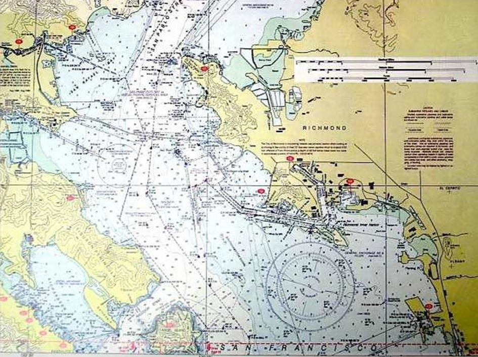
-See Chart No. 18649 below or click on it for the full chart (depths are in feet).
- Do NOT cut corners as the waters outside the markers are deceptive and shallow.
- Green marker 17 is very small, in spite of the claim that should be visible for 6 miles and is usually hidden amongst all the barges and buoys. Use your GPS or chart plotter to find it.